TempAqua -
Exploring catchment hydrology and water quality of temporary streams in Switzerland
Exploring catchment hydrology and water quality of temporary streams in Switzerland
PhD student: Izabela Bujak
A grand challenge in hydrology is understanding how rainfall is stored in catchments and how stored water eventually becomes streamflow. Decades of studies have shown that the majority of streamflow arises from previously stored water exfiltrating as it is displaced by incoming rainfall. Thus, stream discharge and streamwater quality are tightly coupled to the temporal variations in catchment water storage. However, only few studies have experimentally investigated the relationships between subsurface water storage and streamflow generation at the catchment scale because extensive instrumentations are required for monitoring ground- and streamwater properties.
A grand challenge in hydrology is understanding how rainfall is stored in catchments and how stored water eventually becomes streamflow. Decades of studies have shown that the majority of streamflow arises from previously stored water exfiltrating as it is displaced by incoming rainfall. Thus, stream discharge and streamwater quality are tightly coupled to the temporal variations in catchment water storage. However, only few studies have experimentally investigated the relationships between subsurface water storage and streamflow generation at the catchment scale because extensive instrumentations are required for monitoring ground- and streamwater properties.
In the TempAqua project, we will use the temporary stream network in montane catchments as a natural indicator of catchment water storage variations: the geometry and extent of the temporary stream network demonstrate where flows exceed subsurface hydraulic transmissivity at any point in time. Thus, when subsurface water storages are greatest, the stream network should be most extensive; in contrast, in times of drought when water storages are depleted, the temporary stream network should be least extensive. Until now, experimental data sets on temporary stream networks dynamics are rare because data collection faces several challenges: visual mapping of actively flowing streams can be very subjective and time consuming; aerial surveys are not practical in forested or snow-covered terrain or during precipitation events; satellite images are too coarse to distinguish small headwater channels (<0.5m width) from the surrounding landscape and are not usable when clouds cover the view.
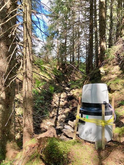
Therefore, in this project, we will continuously map temporary stream networks through wireless sensor network technology in multiple montane headwater catchments in Switzerland with the ultimate goal to infer how different storages in the landscape release water into streams. In addition, hydrochemical data and stable water isotopes will be used as environmental tracers to quantify the dominant flow pathways and water sources that contribute to streamflow. Finally, the linkages between catchment storage variations and temporary stream networks will be explored through numerical hydrological modeling frameworks. The catchment models will then serve as hypothesis-testing tools to assess how future climate change will affect water availability in the montane study regions. The outcomes of this project will have great relevance for improving our process understanding of water sources, biogeochemical fluxes, and ecological habitat resilience in mountainous environments - under actual and prospective future conditions.
This project is supported by the Swiss National Science Foundation SNSF (grant number 185931).
The project duration is from April 2020 - April 2025.
The project duration is from April 2020 - April 2025.


