Rietholzbach Research Catchment
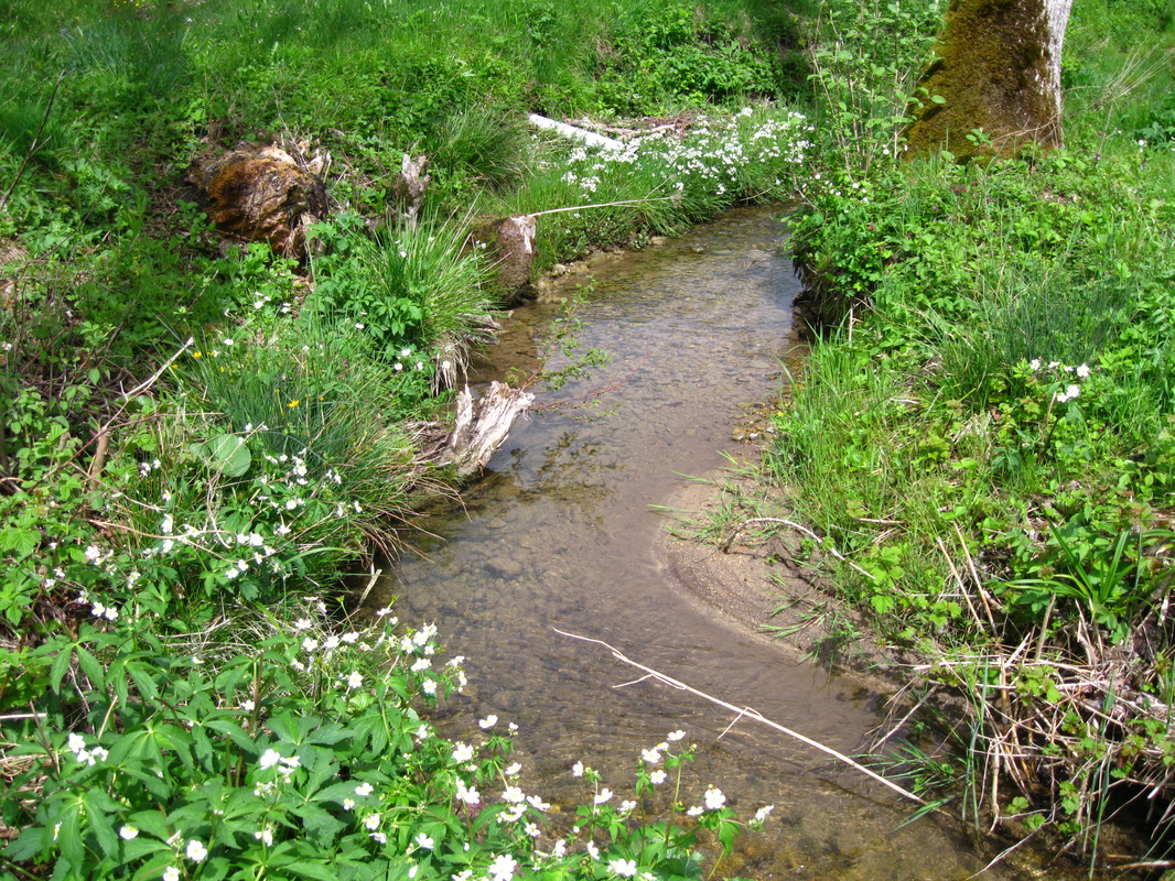
The Rietholzbach Research catchment is a small pre-Alpine catchment located in the headwaters of the Swiss Thur River basin. The Rietholzbach catchment covers an area of approx. 3.31 km2 and an altitude range from 682 to 950 m. The local climate is characterized by temperate humid conditions with high rainfall rates in late spring and summer. The landscape is covered by grassland (more than 2/3 of the area is used as pastureland) and forests.
The geology is composed of the Tertiary Upper Freshwater Molasse (UFM) that forms steep slopes and plateaus at higher elevations. Pleistocene glacial moraine deposits (GMD) overlay the UFM in the valley bottom. The dominant soil types in the catchment are Regosols on the UFM, and Cambisols on the lower slopes of the GMD. Gleysols and peaty soils can be found at the flat valley bottom areas.
More information about the catchment properties and ongoing research can be found here.
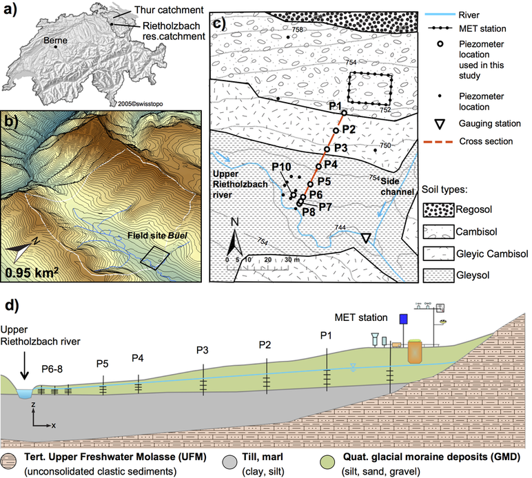
Modified from: von Freyberg, J., Radny, D., Gall, H.E., Schirmer, M., 2014. Implications of hydrologic connectivity between hillslopes and riparian zones on streamflow composition. Journal of Contaminant Hydrology, 169: 62-74. DOI:http://dx.doi.org/10.1016/j.jconhyd.2014.07.005
Instrumentation
Hydrometeorological research in the Rietholzbach began in the late 1970's, when it was equipped with streamflow gauging stations, a meteorological station and a large weighting lysimeter (field site Buel). The Rietholzbach hydrometeorological site is managed by the Land-Climate Dynamics group at ETH Zurich.
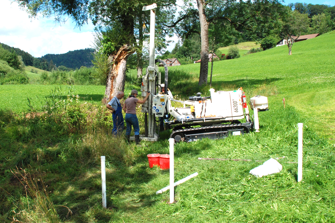
Between 2011 and 2013, I installed 18 piezometers along the hillslope near the field site Buel to study the role of groundwater for streamflow generation and solute transport.
Between 2011 and 2013, I installed 18 piezometers along the hillslope near the field site Buel to study the role of groundwater for streamflow generation and solute transport.
Measured Data
Following data sets were measured between 2011 and 2014 in the Upper Rietholzbach catchment (see map below) and are available for research purposes upon request:
- Groundwater table depths along the transect, 15min temporal resolution*
- Electrical conductivity in groundwater and river water, 15min temporal resolution*
- Temperature in groundwater and river water, 15min temporal resolution*
- pH in groundwater and river water, weekly measurements in 2012*
- Ion- and nutrient data (TOC, DOC, Cl-, SO42-, Na+, Mg2+, Ca2+, K+, SiO2, TP, PO43-, TN, NO3-) in groundwater and river water, weekly measurements in 2012*
Hydrometeorological data and detailed information about the existing research infrastructure is provided on the website of the Land-Climate Dynamics group at ETH Zurich.
* For a more detailed description please see von Freyberg et al. (2014) Journal of Contaminant Hydrology, 169: 62-74. DOI:http://dx.doi.org/10.1016/j.jconhyd.2014.07.005

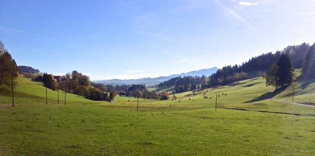
View over the Rietholzbach catchment, looking west (photo: J. von Freyberg)
